
Services
Land Survey
Land Survey
Land surveying is the science of accurately measuring and mapping land areas to determine boundaries, surface features, and topography. It plays a vital role in construction, property development, infrastructure planning, and legal documentation. Using advanced tools like Total Stations, GPS, drones, and digital mapping software, land surveys provide precise data essential for safe and efficient project execution. At Asian Survey, we deliver reliable land surveying services tailored to meet the needs of residential, commercial, and government clients.

Topo Survey
Topographic Mapping Survey
A Topographic Survey captures the natural and man-made features of a site, including elevations, trees, buildings, roads, and utilities. It’s essential for planning construction projects, landscape design, and infrastructure development.
Contour Survey
Contour Survey
Contour Surveys measure the elevation of land at regular intervals, helping in the design of drainage systems, road alignment, and slope analysis. It's particularly useful for construction on uneven or sloped terrain.

Quantity Survey
Quantity Survey
This survey calculates the volume of earthwork—such as excavation and filling—required for construction. It's crucial for estimating material costs and planning project execution efficiently.

Road Survey
Road Survey
Road Surveys help in the alignment, planning, and construction of new roads or the improvement of existing ones. It includes horizontal and vertical alignment, gradients, and cross-sections for accurate road design.

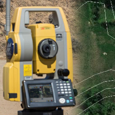
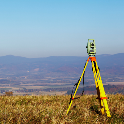
Total Station Survey
Total Station Survey
A Total Station Survey uses advanced electronic equipment to measure distances, angles, and elevations with high accuracy. It’s ideal for detailed mapping, construction layout, and topographical data collection.
Hill Survey
Hill Survey
Hill Surveys are conducted in sloped, uneven, or mountainous areas. They provide accurate elevation and terrain data for infrastructure projects like roads, bridges, and hill settlements.

Digital Survey
Digital Survey
Digital Surveys use modern technology such as drones, GPS, and GIS to capture and process land data. These surveys are efficient, precise, and offer easily shareable digital formats for planning and analysis.

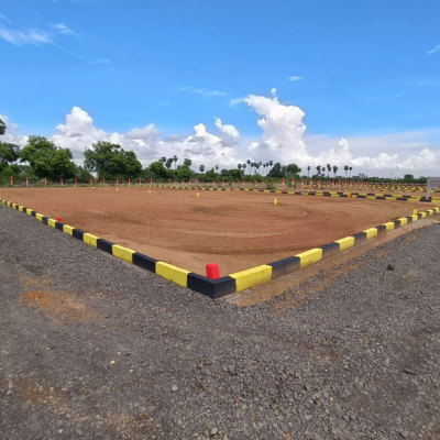
Layout Survey
Layout Survey
A Layout Survey involves placing physical markers on the ground to represent the planned structure, such as roads, plots, or utilities. It helps builders follow the exact design on-site during construction.

Boundary Survey
Boundary Survey
A Boundary Survey identifies the exact legal property lines and corners of a land parcel. It’s essential for property disputes, fencing, land sales, and construction near property boundaries.

Building Setting Out Survey
Building Setting Out Survey
Similar to layout surveys, this involves transferring the design from drawings to the ground, marking the foundation lines, walls, columns, and other structural points to guide construction activities.